Occasional thoughts of an Anglican Episcopal priest

Category: Travel (Page 6 of 8)

Another Walk through the Connemara

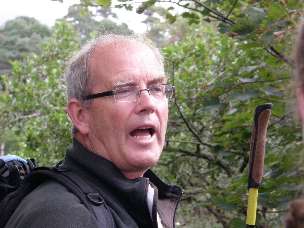
Yesterday and today our student body toured the demesne of Ballynahinch Castle, wandered the narrow main street of Roundstone, and climbed a steep, rocky, boggy hill outside of Cashel in the company of Michael Gibbons, a native of Connemara who is one of Ireland’s leading field archaeologists, a writer, broadcaster, and mountaineer. He is a former director of local and national archaeological survey programs. In his talks about holy wells, ancient burial sites, and the history of the Gaelic lords, it was quite evident that he is very knowledgeable about Irish history especially the pilgrimage tradition in Ireland. I later learned that he spent three years excavating the summit of Croagh Padraig, climbing more than 2,500 feet to work every morning. He certainly moved skillfully and quickly up the hillside in Cashel!

Michael Gibbons, Irish Archeologist and Historian

Michael Gibbons, Irish Archeologist and Historian

Michael has supervised archeological work in such diverse places as the Negev Desert, Egyptian Sinai, and Southern Greece. He has lectured throughout Ireland, at Oxford and Cambridge, at the American National Geographic Society, and at the Smithsonian Institution in Washington, D.C. It was quite a privilege to spend an afternoon hillwalking with him. (Half of the students when on his tour on Monday and half today. I was in the second group.)

Our first stop was at Ballynahinch Castle, a place where Evelyn and I spent a couple of days on our first trip to Ireland in 2005. I was disappointed that today we didn’t actually go into the hotel (yesterday’s group apparently did), but simply roamed the demesne following a circular path around the castle itself.

Ballynahinch Castle Hotel

Ballynahinch Castle Hotel

A famous resident of Ballynahinch was Richard Martin, also known as “Humanity Dick”, founder of The Royal Society for the Prevention of Cruelty to Animals (RSPCA). His ancestors took over the house in 1590. His father the present manor house in the early 1700’s as an inn, the same purpose it now serves as one of the finest hotels in Ireland.

The name Ballynahinch comes from the Irish Baile na hInse meaning “settlement of the island”, a reference to the small island fortress in the lake over which the castle looks. The estate comprises 450 acres of woodlands, gardens, lakes, and rivers, just a small portion of the more than 200,000 acres which the “The Ferocious O’Flahertys” ruled from this place. The lands of the O’Flaherty clan stretched to within fifteen miles of Galway City on the east and into County Mayo to the north-west. The clan leaders were the Gaelic Lords of Connaught and held castles at Ballynahinch, Aughanure, Doon, Moycullen, Bunowen, and Renvyle.

Crannog in Ballynahinch Lake

Crannog in Ballynahinch Lake

Perhaps the most famous O’Flaherty was Grace O’Malley from Mayo who married Donal O’Flaherty in 1546. Called the Pirate Queen of Connemara, she is well known for her meeting with Queen Elizabeth I in 1593. At the age of 63 years at the time, she was said to be an awesome and formidable lady. Although Irish was her native tongue, Grace conversed comfortably the English queen in Latin. An English court scribe described her this way: “In the wild grandeur of her mien erect and high before an English Queen she dauntless stood.”

On the grounds of the estate, Michael Gibbons showed us a holy well dedicated to St. Feithin (Festus), one of several which stretch in a fairly straight line from east to west across this part of Ireland. He explained the importance and history of holy wells in the folk religion of Irish people. What I found of interest is that holy wells were disliked by and the tradition actively discouraged by both Anglican evangelical missionaries and the French-trained Roman Catholic clergy who came to this area after English law again permitted Catholicism to be practiced; nonetheless, the tradition continued and even today one finds holy wells as places of reverence throughout this nation. The Roman church seems to have learned the lesson that this sort of folk religion cannot be obliterated and so has adopted many of these sites as places of pilgrimage. The holy well at Ballynahinch, however, is not one of them as it has dried up (according to legend it did so because it was insulted by a Protestant).

Tobar Feithín on the grounds of Ballynahinch Castle

Tobar Feithín on the grounds of Ballynahinch Castle

We also saw, from a distance, the island fortress or crannog from which the area gets its name and the remains of a 16th century cannon used by the O’Flaherty’s to defend their headquarters. (The term crannog refers to emplacements on small islands, often artificial ones; remains of them can be found in many of Ireland’s lakes. The name is derived from the old Irish crannóc from crann, tree. These islands in many cases were fortified and lived on by people as late as the 17th century.)

After hiking around Ballynahinch, we drove to Roundstone where we spent an hour having lunch. I’ve written about Roundstone in another post on this blog.

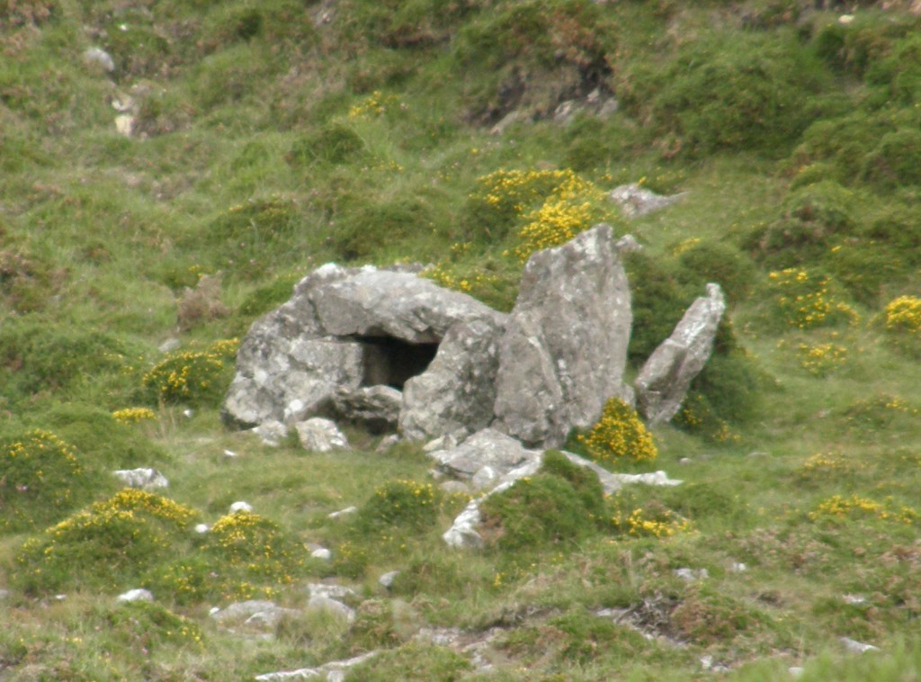
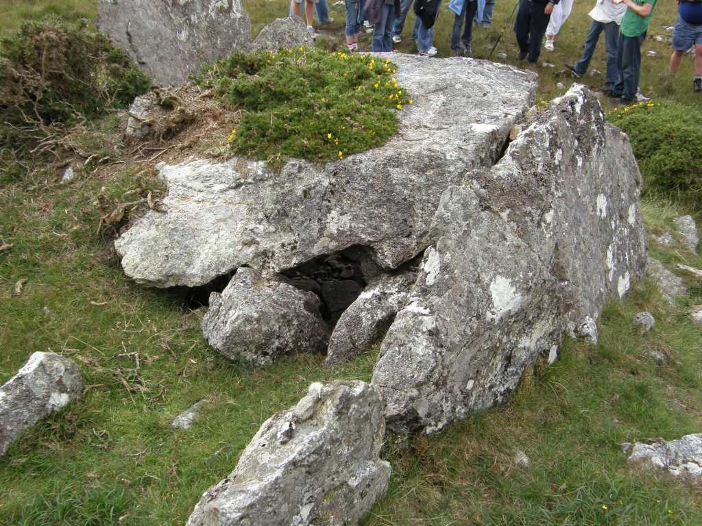
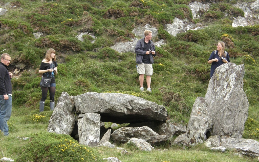
Our bus next took us about twenty minutes south of Roundstone to Cashel Hill (Cnoc an Cháisil) where we climbed about eight hundred yards up the hill from a roadside cottage to a megalithic tomb dating from the end of the Stone Age or beginning of the Bronze Age, about 4500 years ago. It is known locally as Altoir Ula (altoir means “altar” and ula refers a tomb or penitential station ); it is also said to have been a “Mass Rock”, a place used by outlaw Roman Catholic priests to celebrate Holy Communion when Roman Catholicism was illegal during what are called “the Penal times”.

Megalithic Tomb, Cashel Hill, Connemara, Co. na Gaillimhe, Éire

Megalithic Tomb, Cashel Hill, Connemara, Co. na Gaillimhe, Éire

Looking like a low hut built out of a few massive and irregular stone slabs, it is a wedge-shaped gallery grave. Its chamber narrows towards the rear or eastern end. The cap-stone forming its roof is about five feet square and sixteen inches thick, and rests on smaller slabs set edgeways in the ground to form the sides, which are the interior stones of double-sided walls. One of these outer slabs, five feet high, stands forward of the main chamber as a sort of portico at the front of the tomb. Originally the whole construction would have been covered by a cairn, traces of which can be seen around it. This is the only known megalithic tomb in the South Connemara area.

Megalithic Tomb, Cashel Hill, Connemara, Co. na Gaillimhe, Éire

Megalithic Tomb, Cashel Hill, Connemara, Co. na Gaillimhe, Éire

Megalithic Tomb, Cashel Hill, Connemara, Co. na Gaillimhe, Éire

Megalithic Tomb, Cashel Hill, Connemara, Co. na Gaillimhe, Éire

Megalithic Tomb, Cashel Hill, Connemara, Co. na Gaillimhe, Éire

Megalithic Tomb, Cashel Hill, Connemara, Co. na Gaillimhe, Éire

Megalithic Tomb, Cashel Hill, Connemara, Co. na Gaillimhe, Éire

Megalithic Tomb, Cashel Hill, Connemara, Co. na Gaillimhe, Éire

Megalithic Tomb, Cashel Hill, Connemara, Co. na Gaillimhe, Éire

Megalithic Tomb, Cashel Hill, Connemara, Co. na Gaillimhe, Éire

After the tomb, Michael showed us a nearby active bog and explained how bogs grow. He showed us how to walk through bog safely (don’t ever try to jump from place to place!) and demonstrated the buoyancy of a bog mat. One of our classmates, Mara B., stepped out onto the mat (at Michael’s invitation). It was fascinating the way the “ground” in the bog bounced as others walked across it. The mat on which Michael and then Mara stood moved dramatically! The bog water around the mat may have been as many as 18 feet deep; Michael probed with his 5-foot walking stick and met no resistance. The bog is much like quicksand and can suck a person under in just a few minutes.
Active bog area, Cashel Hill, Connemara, Co. na Gaillimhe, Éire

Active bog area, Cashel Hill, Connemara, Co. na Gaillimhe, Éire

Mara B., active bog area, Cashel Hill, Connemara, Co. na Gaillimhe, Éire

Mara B., active bog area, Cashel Hill, Connemara, Co. na Gaillimhe, Éire

A Drive Through the Bog

On a recent afternoon I had one of those introversive episodes when I needed to get away from everyone, from the teach lóistín (“boarding house”) where I am staying, away from housemates, host family, school, and so forth. So I told my bean an tí (“landlady”) that I wouldn’t be home for dinner, got in my rental vehicle (an Opel Astra), and drove away.

My first and only planned stop was at a famine house in the northern precincts of An Cheathrú Rua which I had seen from our school bus when returning from one of our “tours”. Unfortunately, I discovered that the property is fenced off by a vicious looking barbed wire fence, so the photos I had hoped to take, and did take, are all from a distance. I’d hoped to go inside it and take some interior shots, but alas ….

Famine House, An Cheathrú Rua

Famine House, An Cheathrú Rua

I then drove to what passes for a “main highway” in these parts; from an American perspective these are very narrow roads on which the Irish drive at unreasonably high speeds. I turned toward Leitir Moír, deciding on a moment’s notice that since I am familiar with the Irish folk song Peigín Leitir Móir (I can even sing part of it), I should be able to say that I’d been to the town. I have now been … it’s not much; it’s just a small Irish town with a “city center” consisting of a Roman Catholic church, a small park (and car park), a community activity center, and little grocery store. But the song is still catchy and fun – if you want to hear it, click here for a YouTube video of an Irish folk singing family singing it.

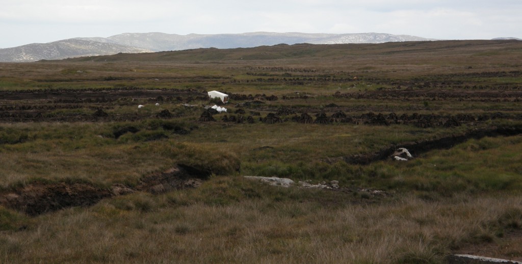
After Leitir Moír, I decided to go to Cloch na Ron (the Anglicized name of which is “Roundstone”, although the Irish actually means “rock of the seals”) and maybe have a bite to eat. That turned out to be a drive through “the bog” which is the area where locals “cut turf” to be used as fireplace fuel during the winter. I took some pictures of turf cutting along the way and enjoyed the views of the Twelve Bens which are the mountains of the Connemara. Lots of people go “hillwalking” among these mountains, a very popular holiday (vacation) activity for the Irish.

The Twelve Bens from Derryrush Road

The Twelve Bens from Derryrush Road

It is estimated that bogs cover about one-sixth of the available land in Ireland, which gets more of its fuel from peat than any country except Finland. In Ireland, many families have an inherited right to cut turf for domestic use which has been handed down for hundreds of years. This inheritable right is called turbary.

The Bog, Showing Family Turf Cutting or "Turbary" Areas

The Bog, Showing Family Turf Cutting or "Turbary" Areas

Here in the west of Ireland, the bog is technically a lowland blanket bog. These are unique in that they are formed in a rainfall-rich locale where the supply of minerals is kept up and the acidity down. The makeup of the bog material includes vegetation of many types.

According to tradition, turf is not cut until after St. Patrick’s Day after the March winds dry the boglands. Early May is generally the turf-cutting time in the West of Ireland, although it continues through the summer months and is still going on while I am here. My host family has gone out to the bog to cut turf, although I’ve been unable to go along because of classes a that the Acadamh. While driving the Derryrush Road from An Cheathrú Rua to Cloch na Ron, I witnessed an old man in rubber boots stacking footings and took the photos you see here. (In retrospect, I wish I’d pulled over – if I could have found a wide enough, dry enough spot to do so – and asked the old man about his activity … 20-20 hindsight!)

In some areas, before turf is cut the top layer of heather and roots is stripped; this can be done by the time consuming process of mowing the vegetation and then cutting back the top layer of soil, or by burning. Burning requires a permit, which is often difficult to obtain.

The Bog, Showing Turf Cutting "Ridge"

The Bog, Showing Turf Cutting "Ridge"

In this area, they don’t seem to strip the bog first. The top layer is fairly sparse here, so the turf is simply cut through the top surface. Generally, it takes one man a week of cutting to prepare a year’s worth of turf fuel.

Antique Slane (Modern Tools Have Steel Blades)

Antique Slane (Modern Tools Have Steel Blades)

Turf cutting is done with a sléan or slane, a long-handled turf spade with a shaped steel end. Slane styles vary from county to county. The direction of the cutting varies from place to place. In this area, turf is cut in a vertical direction; where the bog type is what is called a red raised bog, it is cut in a horizontal direction.

Dried Sods Ready to Burn in the Fire

Dried Sods Ready to Burn in the Fire

The depth of a single piece of cut turf is called a spit or a bar. A vertical turf bank is measured in numbers of bars to a depth of a slane (twelve to eighteen inches in this area.) A good bank might be six bars deep; I’m told that a day in the bog is difficult work and taxes the strength of even the fittest person. The bog is very wet and the trenches created as turf is cut fill almost immediately with water; cutters usually wear high gum or rubber boots. The lowest row of bars is the wettest, but they say that when dried they make the best fuel.

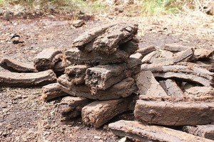
The cut turf is removed to open ground to dry. The soggy sods, as the brick shaped cuttings are called, are laid out on the ground to dry for a week. They are then stacked upright into a footing which continues the drying procedure.

A Field of Footings Next to the Trench or Ridge from which they were cut

A Field of Footings Next to the Trench or Ridge from which they were cut

Close-Up of Footing

Close-Up of Footing

Once the footed turf is somewhat dry, sods are piled into a rickle. When it is finally dry, the turf is carried home to be stacked against an east-facing wall or in a covered shed for protection from westerly winds.

A "Rickle" or Pile of Turf Ready to be Transported Home

A "Rickle" or Pile of Turf Ready to be Transported Home

In the past, turf cutting was only fuel available to many families living in the Connemara, where it is illegal to cut it other than by hand. Many families still use turf for homeheating, although today it can be purchased in compressed briquettes in supermarkets throughout Ireland. I’m told that turf burns cleaner than coal; it has a very a pleasant smell which, together with the smell of mown heather, has come to really be the scent of Ireland to me. There’s nothing quite so comfortable as sitting by a turf fire on cold, damp day with a mug of tea (or in my case, coffee) in hand. I’m told that scones cooked over a turf fire have an especially lovely flavor – I’ve not had (nor do I anticipate having) that experience, but I can imagine that it is true.

After my drive through the Bog along Derryrush Road, I connected with one of the small “highways” of Ireland and made it to Roundstone, which was a bit of a mess. It is a fishing village turned vacation resort. One very narrow street along the waterfront, several B&Bs and a few pubs/eateries. It was a “mess” because next Thursday is the running of the Tour de Bog, a bicycle road race that begins and ends in Roundstone and they were setting up signs, starting/ending line, viewer stands, etc. Some guy with a trailer was trying park it on the main street where there was patently no space to park it! So a long line of cars waited about fifteen minutes for the fruitless maneuvering to end.

I finally parked in the free public parking area and walked to a local pub – had a pint of Smithwick’s ale with the barkeep, a woman about my age who bemoaned the Irish economy and the fact that at 6 p.m. on a Friday evening she had absolutely no business. For the first twenty minutes or so, I was the only customer in the place, then a French family entered and since they had very little English and she had no French, I served as translator.

I finished my beer, bade my new friends farewell – “Adieu!” and “Bon nuit!” to the French family, “Slan!” and “Oíche mhaith!” to the Irish tavern owner – headed back to the car where I noticed that the music shop of Malachy Kearns, reputed to be the best bodhran (Irish drum) maker in Ireland, was open.

I bought a bodhran there in 2005 when Evelyn and I made our first trip to Ireland. We also bought a CD that I really, really liked, but which we gave to a friend (after making a bootleg copy for ourselves, a copy which has since disappeared). I thought I might find another copy but, alas, the stock at Malachy’s store has been replaced with Celtic Woman and a bunch of touristy “moods” CDs that you can find in any Celtic-Gaelic store in the USA. So I bought nothing.

I headed back to An Cheathrú Rua, covering the same roads in the reverse direction (I thought “Jack the GPS” might take me a different route, but no). I got back to town just in time for a really good lecture on “the function of music in the Irish tradition” by Breandán Ó Madagáin, an elderly professor from NUIG. Old he may be, but he has a great singing voice. He really knew his stuff. I had a chance to talk with him briefly about my project and he gave me a copy of an ethnomusicology article he had written which references and briefly discusses the hymnal I’m working on.

After the lecture, I headed for home and bed.

A Visit to Inis Oírr

On Saturday, 23 July 2011, the students of the Acadamh na hOllscolaíochta Gaeilge boarded a bus, traveled 45 minutes to Ros á Mhil, boarded a ferry (Banrion na Farraige, “Queen of the Sea”) and journeyed to the smallest of the Aran Islands. Inis Oírr (Inisheer), a name derived from Inis Oirthir meaning “island of the east”, is the most eastern of the islands. About 3 square kilometres in size, Inis Oírr is a walker’s paradise. Posts with a “walking man” symbol mark a route around the island which can be completed in about four hours; we didn’t have quite that amount of time and covered only about half of the trail.

The island is a limestone pavement rising to a highest point of 60 meters above sea level. The flora and fauna include many extremely rare species, some of which are under conservation order. Fifty-seven species of birds, thirty-two kinds of wildflower and grass (including a species of darnell grass and one of cornflower found nowhere else), and three types of bumblebee share the island with about 250 human beings.

From Inis Oírr pier

The heights of Inis Oírr seen from the island's pier

Inis Oírr has been inhabited for more than 5,000 years; arrowheads and flint from the Stone Age have been recovered at various locations on the island. Later evidence, from the Bronze Age, comes from urns and bones excavated at a burial site called Cnoc Raithní (“hill of ferns”).

Christianity came to the islands before the end of the first millennium. Near the swimming beach next to the ferry pier is the island’s graveyard. Here one finds the buried church called Teampall Chaomhain (“St. Caomhan’s church”). This is a 10th Century church said to have been founded by St. Caomhan (“Kevin”), a disciple of St. Enda the Patron Saint of the Aran Islands. (This St. Kevin is said to be the older brother of the St. Kevin who founded the monastic community at Glendalough.) The church was nearly buried by drifting sands, but has now been excavated and is kept clear of sand by the residents. It is a beautiful and peaceful place looking out over the ocean.

Further inland is Cill Ghobnait (“St. Gobnait’s church”) or Teampall Beag (“small church”) which was built in 11th Century and is dedicated to Saint Gobnait. It is built on a site which may have had an early church from before the 9th Century and does include the remains of a clochán or hermit’s beehive cell. Although Saint Gobnait is linked to Ballyvourney in County Cork, she is believed to have been a native of County Clare (the closest mainland county to the islands). The islanders believe she fled to Inis Oírr and lived in the clochán. (What she may have been fleeing from, we were not told.) Around the ruins of the church here three outdoor altars (which may mark graves), two bullaun stones, and the clochán. (Bullaun stones are basically holy water fonts. Local folklore often attaches religious or magical significance to them, including the belief that rainwater collecting in a bullaun stone’s hollow has healing properties.)

Cill Ghobnait - Teampall Beag

Cill Ghobnait - Teampall Beag

Altar of St. Gobnait's Church

Altar of St. Gobnait's Church

Stone altar outside St. Gobnait's Church and Bullaun Stone

Stone altar outside St. Gobnait's Church and Bullaun Stone

Remains of clochán or hermit's beehive hut at St. Gobnait's Church

Remains of clochán or hermit's beehive hut at St. Gobnait's Church

In medieval times, the Aran Islanders lived in “chiefdoms”, the largest example of this is the hillfort at Dún Aonghasa on Inis Mór. The Aran Island chiefs were powerful and wealthy men who controlled the western sea passages; they contracted with the merchants of Galway keep the approaches to Galway Bay free from pirates in exchange for protection money, but apparently were not against a bit of pirating themselves. The islands became known as a haven for foghlaí mara (“sea plunderers”, i.e., pirates).

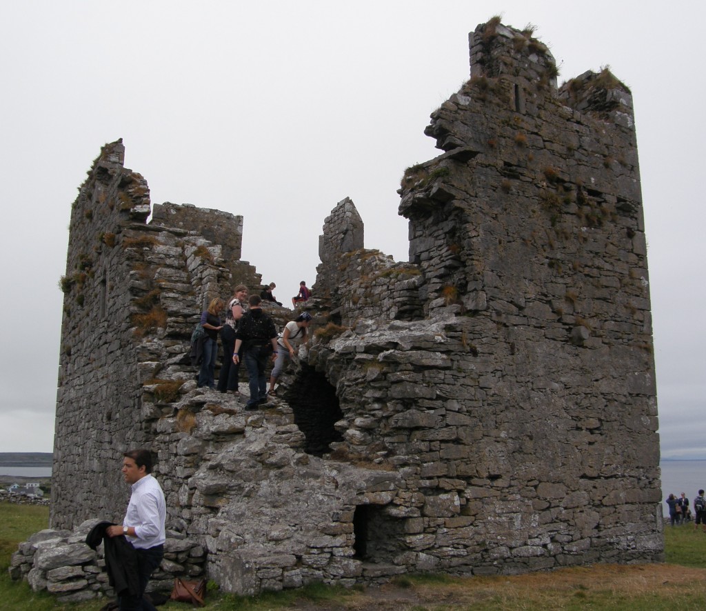
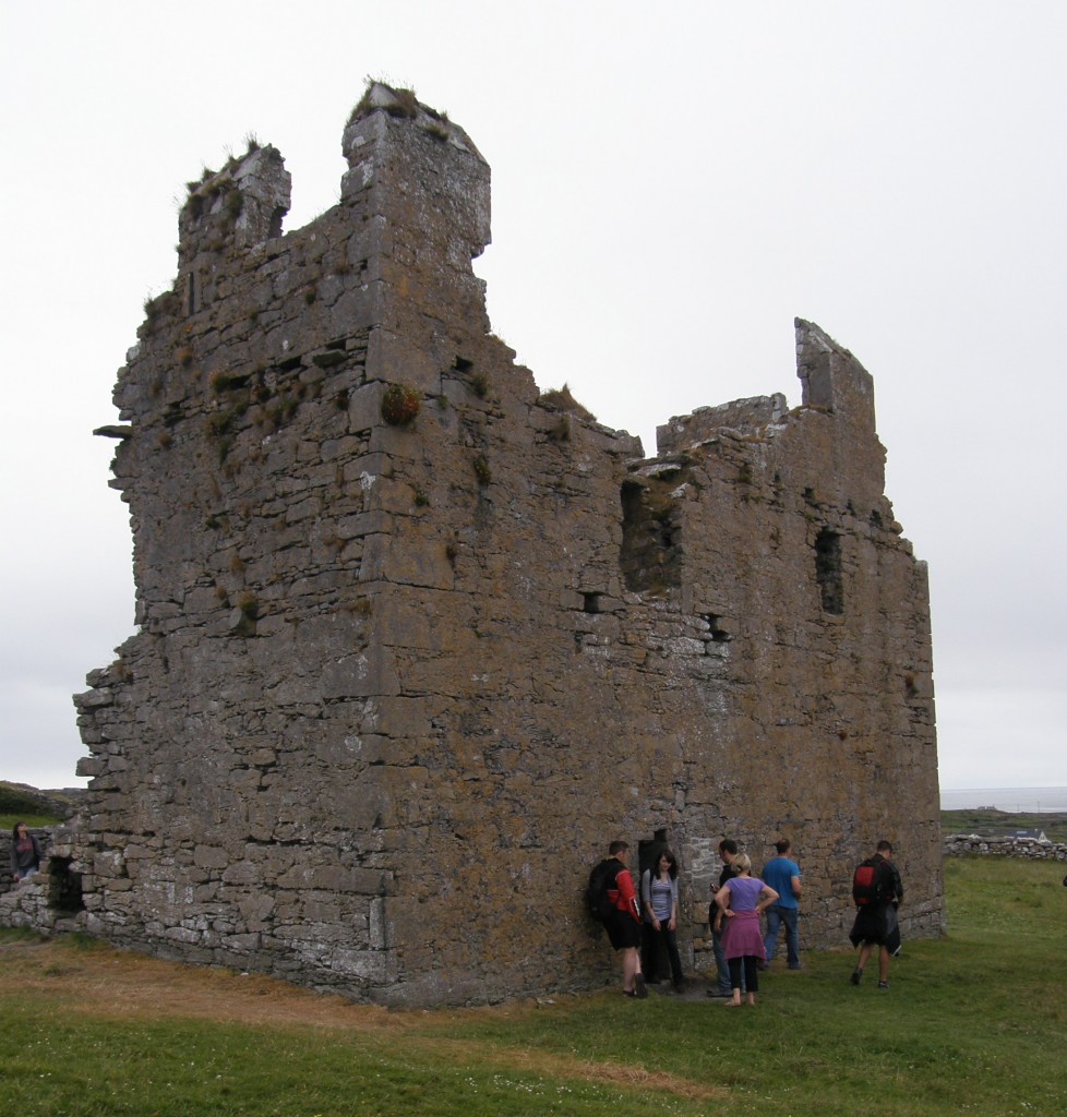
In the 14th Century, Inis Oírr became a base of the powerful O’Brien family and Caislean Uí Bhriain (“O’Brien’s Castle”) on was built here. The castle was taken from the O’Briens by the O’Flaherties of Connemara in 1582. It was occupied by them and others until 1652, when the Aran Islands were surrendered to Cromwellian forces.

O'Brien's Castle

O'Brien's Castle

O'Brien's Castle

O'Brien's Castle

In the early 19th Century, it was feared that Napoleon might invade Ireland and watchtowers and Martello towers were built all around the island nation, including a watchtower on Inis Oírr. The French never came and the watchtower became a school and an additional building was built next to it. Children would be schooled for the first several years in this local school and then would travel by boat to schools on the other islands or to the mainland.

Napoleonic era watchtower

Napoleonic era watchtower

School building constructed next to, and incorporating, watchtower

School building constructed next to, and incorporating, watchtower

Inis Oírr’s history is strongly linked to the sea; the sea provided food for islanders to live on, and protected them from famine. The cargo vessel Plassey was shipwrecked off Inis Oírr in the 1960s, and has since been thrown above high tide mark at Carraig na Finise (a beach) on the island by strong Atlantic waves. The islanders rescued the entire crew from the stricken vessel, the wreckage of which has become a tourist attraction on the island. Unfortunately, with our limited time we were unable to see the ship wreck.

This marks my third visit to the Aran Islands. Evelyn and I visited Inis Mór, the largest, in 2007; I visited Inis Meán with another class from the language school in 2008; and I have now made this visit to Inis Oírr. Although the 21st Century has certainly come to these islands (automobiles and diesel tractors are found on all of them; cell phone reception is superb; one assumes the residents have access to the internet), there is still something timeless and ancient about them. Life clearly moves a different pace. Travel writer A.J. Neudecker has said that “Little Inisheer … is bottled tranquility.” I can see how two or three days on this island would be very restful!

My Daily Walk: The Rocks and the Flowers

An Áras Mháirtín Uí Chadhain (the Martin O’Kyne Center) is located in the village of An Cheathrú Rua on the western coast of Contae na nGaillimhe (County Galway). The name was Anglicized to Carraroe during the time the British Empire ruled Ireland.

There are various stories as to what the Irish name An Cheathrú Rua actually signifies and how it came to be. The word ceathrú means “quarter” and is used in the same way the English word is used, as in ceathrú tar eis a hocht (“quarter after eight” o’clock) or an cheathrú Laidineach (“the Latin quarter”). It is in this latter sense that it is used to name this area.

The debate and the differing stories enter the picture when one considers the word rua. In one sense the word can be translated as “red” or “russet”, most commonly when referring to hair color. With that information you might think that perhaps this is an area populated by large numbers of red-heads, but that is not the case nor is that one of the stories about the area’s name. Rather, the argument is made that the color of the soil on this peninsula (for that is what An Cheathrú Rua is) is a particular auburn color, like that of red hair. Another story dependent on this meaning of rua is that it refers to the blood spilled when a man was killed several centuries ago in a fight outside a public house (one which still exists today).

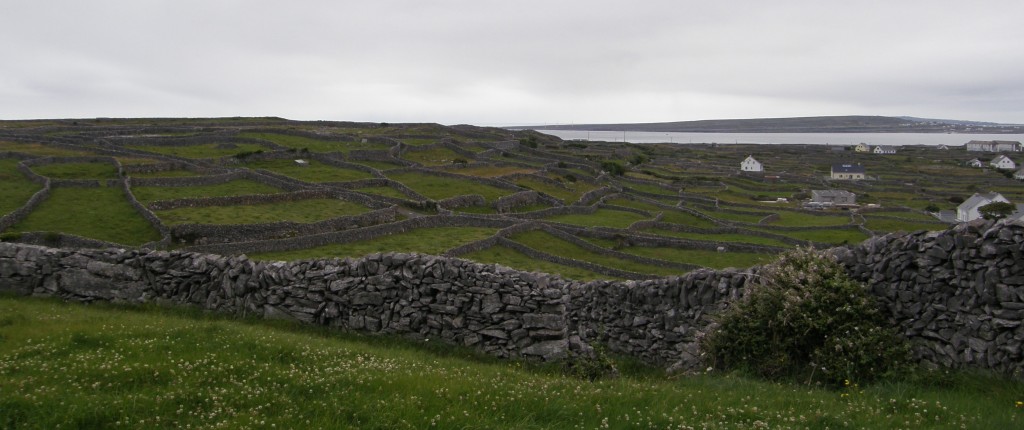
Rock-walled Fields (Inis Oírr)

Rock-walled Fields of Inis Oírr; An Cheathrú Rua has similar terrain.

The etymology favored by most people is based on an alternative meaning of rua: wild, fierce, or rough. The terrain of An Cheathrú Rua is very rough! Like much of this part of Ireland, the ground is rocky and uneven. Granite stones, which are plentiful and readily available, are the preferred building material for homes, other buildings, and the fencing of fields; stones cleared from the small, uneven fields have been used for centuries to wall in those same fields. (One finds this all over the northern half of this island nation and on the offshore islands; I have included in this post a picture from Inis Oírr, one of the Arann Islands, which shows many rock-walled fields terracing the island’s hillside. More about Inis Oírr in a later post.)

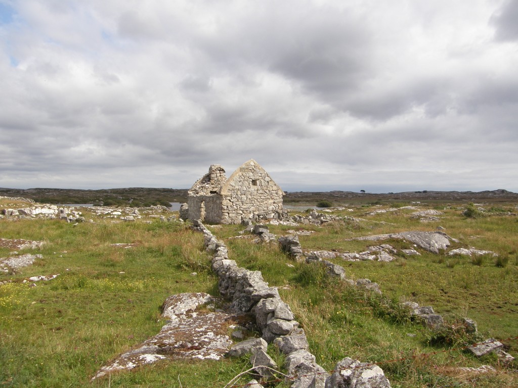
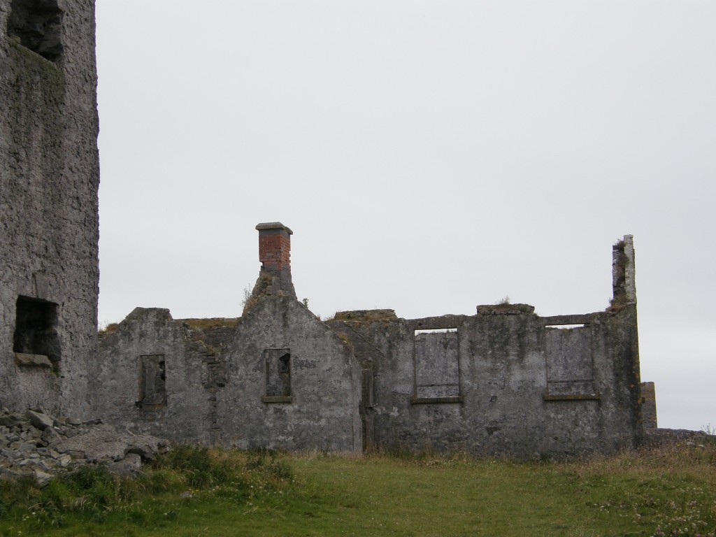
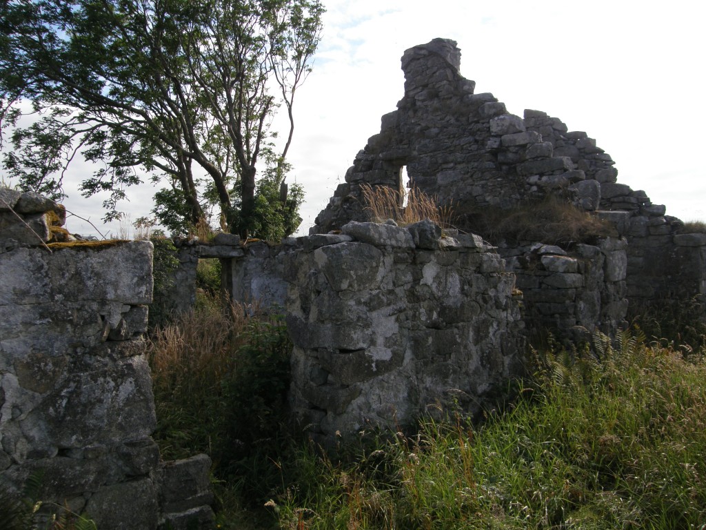
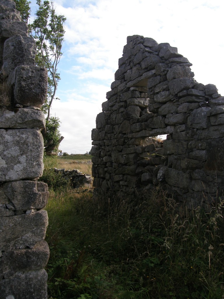
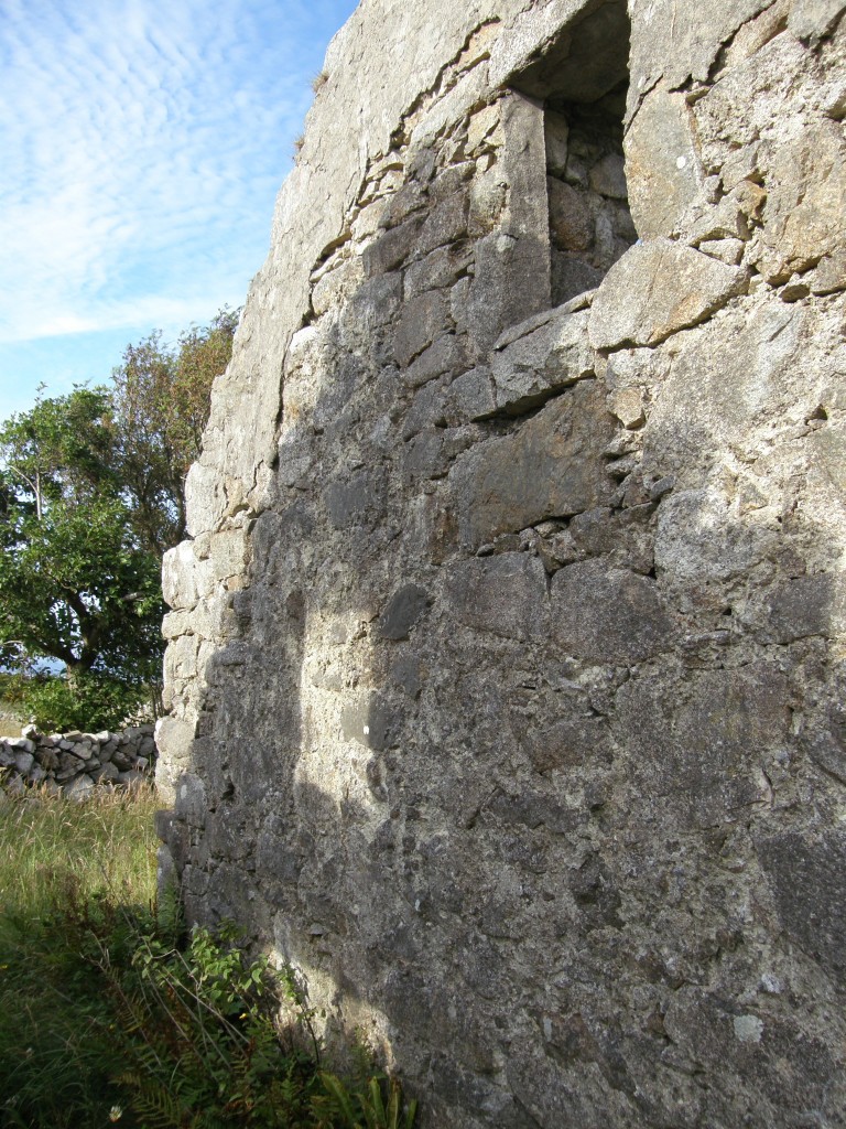
I take a daily walk along some of the winding roads through these rocky fields. (All the road here are winding and narrow; there’s no such thing as a straight road in Ireland!) Along any of these paths, I pass the tumble-down ruins of old stone cottages. These are referred to as “famine houses” for many (if not all) of them date from about 165 years ago, the time of the potato blight and the Irish Famine. Two Irish terms are used to name that time in the country’s history: An Droch-Shaol (meaning “The Bad Life”) and An Gorta Mhór (“The Great Hunger”). As people left the rural areas seeking food in the cities or to emigrate to America, Australia, or other places, they simply packed up and left their homes which, over time, deteriorated and partially collapsed; many of these refugees were evicted from their homes by landlords who were responsible for paying a yearly £4 per person tax on their tenants and who, without those tenants producing income, were unwilling to do so. But the Irish people build their stone homes well, and granite and mortar take time to erode, so the walls of many of these now-ancient structures still stand and those who live amongst them, out of respect for the dead, are loath to tear them down.

Famine House, An Cheathrú Rua

Famine House, An Cheathrú Rua

Famine House, An Cheathrú Rua

Famine House, An Cheathrú Rua

Famine House, An Cheathrú Rua

Famine House, An Cheathrú Rua

Famine House, An Cheathrú Rua

Famine House, An Cheathrú Rua

Famine House, An Cheathrú Rua

Famine House, An Cheathrú Rua

And so these stark reminders of the past are with us everyday. As I walk amongst the homes of the living and the dead, I am also greeted by flowers of all sorts. Though this is a rough countryside difficult to farm, it is lushly overgrown both with the gardens planted by the residents and, along the roads and in the fields, many sorts of wildflowers. Like the Arann Islands a few miles out in the Atlantic and the Burren of County Clare to the south, the climate, the winds, and the sea currents have conspired to bring to this area a variety of plants not usually found growing together. (This is especially true in County Clare where one finds tropical and arctic varieties growing side by side.) I thought I would share with you some of the flowers I see each day.

Fuchsia on Rock Wall

Fuchsia on Rock Wall

Spear Thistle

Spear Thistle

Field Bindweed

Field Bindweed

Wild Blackberry

Wild Blackberry

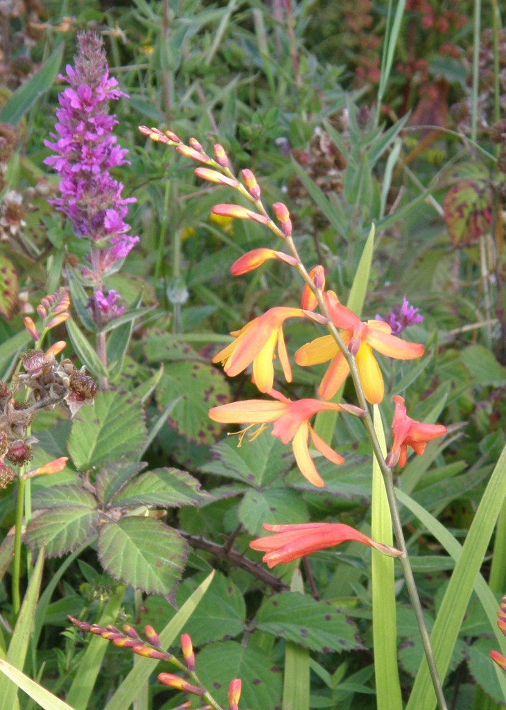
Potts' Montbretia (orange) and Fragrant Orchid (purple)

Potts' Montbretia (orange) and Fragrant Orchid (purple)

Meadow Buttercup

Meadow Buttercup

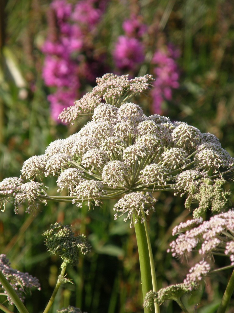
Wild Angelica

Wild Angelica

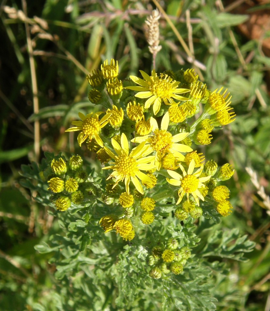
Common Ragwort

Common Ragwort

The Holiness of Creation – 17 July 2011

It is said that there are forty shades of green in Ireland … there are probably more. There seem also to be at least that many shades of gray in the skies of Ireland the past couple of days. Since my arrival here, there have been clouds, wind, and rain. Irish words I learned three years ago come easily to mind: scamallach (cloudy), gaofar (windy), báisteach (rain).

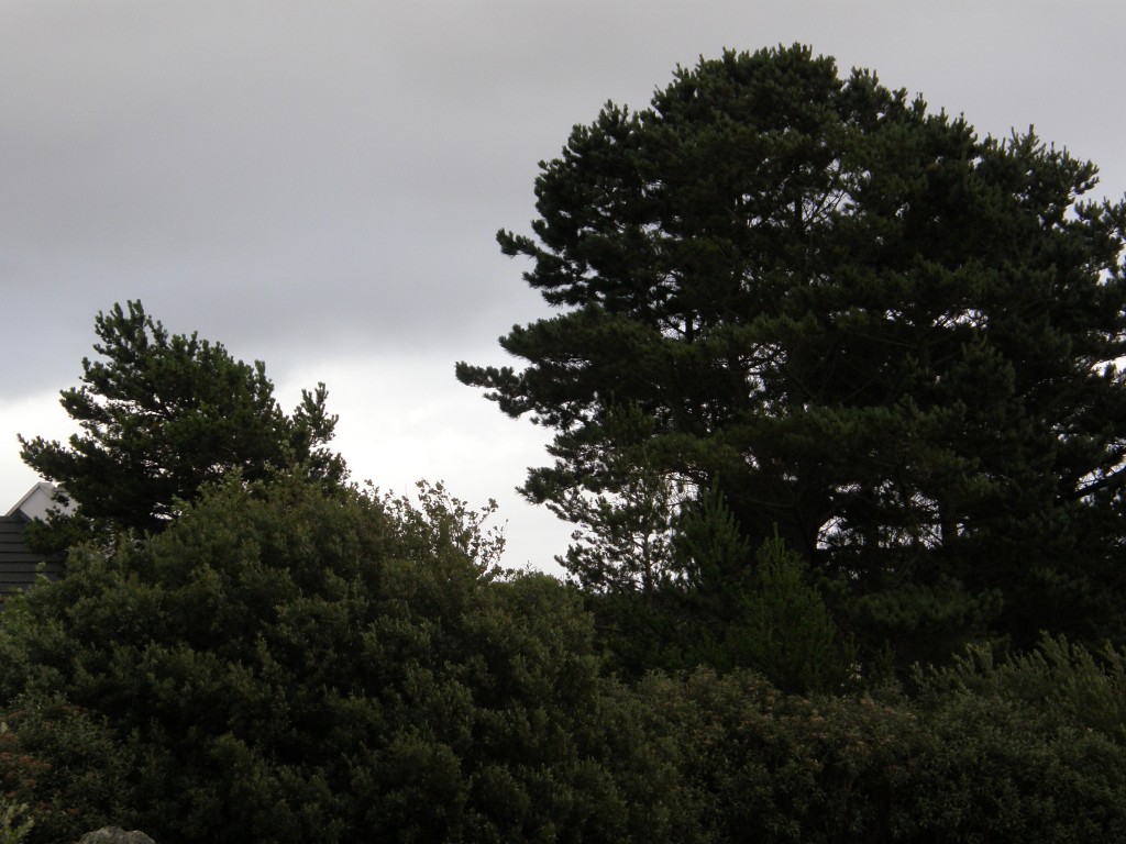
Today, the wind is blowing hard enough that the trees and bushes in the front yard of my teach lóistin (boarding house) are bent far over and whipping about violently. The clouds, seeming low enough to touch, race by overhead, and throughout the day sheets of rain – some of hard, coarse droplets; some of sharp, stinging mist – have come and gone. From time to time a seagull struggles to move against the wind finding ways to travel into the blustery headwind, knowing instinctively when to rise, when to dive, when to tack.

The Windblown Skies of An Cheathrú Rua

The Windblown Skies of An Cheathrú Rua

My housemates are away today – the Acadamh has offered a bus tour to Ros Muc and the cottage in which Patrick Pearce, a hero of the founding of the modern Republic, spent his life. I have made this journey before and so I have opted not to take today’s bus ride. It has given me a chance to study grammar, review vocabulary flash-cards, and read a bit.

But the rain beats against the window and the wind blows so hard the house, though solidly built of concrete block and stone, vibrates; I am constantly distracted by this weather. “Tá an aimsir go-holc,” exclaims the bean-a-ti (literally “woman of the house”, the term – pronounced “BAN-uh-tee” – means both “housewife” and “landlady”). Yes, I think, the weather is wretched.

Olc is an interesting word: its basic meaning is “evil”, but it is used in a variety of ways which would be supplied by different words in English. (Go-holc is a form which would be translated into English by the addition of the adverb “very” to adjective.) It can be used to describe anything from simple “bad luck” to “wretched weather” to “moral evil”. Similarly, a word used to described good weather, álainn, can mean “beautiful”, “delightful”, or “perfect”.

I have been convinced for some time that a people’s spirituality is informed by their language, by its structures, by its grammar, by the alternative meanings of words.

It would, I think, be unlikely to find an English speaker describing the weather as “evil” – wretched, perhaps, and bad, certainly – but “evil” is a term we would reserve for other uses, to describe that which is morally reprehensible, something which can’t be said of the weather. Similarly, while we might describe the weather as “perfect” for some activity, we would not generally describe the weather as simply perfect in its own right.

Thinking of these descriptive terms for the weather I am reminded of a verse of scripture, Matthew 5:48, perhaps most familiar in its King James Version form: “Be ye therefore perfect, even as your Father which is in heaven is perfect.” Although álainn is not the word used in the Irish bible’s version of this admonition of Christ, I can’t help but think that the secondary meaning of the word might suggest to the Gaelic soul a link between the occasional perfection of nature and the perfection of God (or, negatively, between the “evil” of the weather and the Evil One).

Celtic Christianity views the mission of Christ less as a “redemption” of a “fallen” creation than as the “completion” of an “incomplete” creation. I believe the use of these morally and spiritually charged adjectives to describe the weather and to describe nature has contributed to the spirituality which informs this theology. There is a hymn in Dánta Dé which sings the praises of the holiness of all nature and is reflective of this Celtic spirituality.

First, the Irish:

Naomhtha cearda Mhic Mhuire;
Naomhtha ó thus A thrócaire;
Naomhtha grian is neoil nimhe,
Dhá fhiadh eoil na h-aimsire.

Naomhtha a bhfuil thall n-a thigh,
Naomhtha gach dúil dá dhúilibh,
Naomhtha an ré a’s na réaltain,
Naomhtha an Té ó dtaisbéantar.

Naomhtha na síona saobha,
Naomhtha an fhearthain Abraona;
Naomhtha an tsoinionn go ngné ghil,
Naomhtha doinionn Dé dúiligh.

Naomhtha ceathra na cruinne,
Naomhtha cloche ‘s caomh-dhuille,
Naomhtha an teine, giodh h-í ain,
‘S gach ní eile dá n-abraim.

Naomhtha an ghaoth lonn ag labhairt,
Naomhtha fairrge ‘s fíormamaint;
Naomhtha gach aon-mhaith d’ar fhégh,
Naomhtha ‘n éanlait ‘san aedhir.

Naomhtha na coillte fá chnáibh,
Naomhtha an fhíneamhain abaidh,
Naomhtha gach toradh dá dtig,
Naomhtha an talamh ó a dtáinig.

Naomhtha an tráigh ‘s an tuile,
Naomhtha fás na fiodhbhaidhe,
Gníomha naomhtha learg is luibh,
Naomhtha an Ceard do cruthaigh.

Naomhtha fós fóghar na dtonn,
Naomhtha siúbhal na srothann,
Naomhtha an riasg fraochdha ‘s an féar
Naomhtha an t-iasg ‘san aigéan.

Naomhtha A thionsgnamh ‘a A thoil,
Naomhtha oibreacha ‘n Athair,
Naomhtha A cheard ‘s A chreidiomh,
Naomhtha A fhearg ‘s A fhoighideadh.

Naomhtha teaghlach A thoighe,
Naomhtha an Trionóid tóguidhe,
Naomhtha A iomrádh ag gach aon
Naomhtha ró-ghrádh A ró-naomh.

And the English translation by Úna ní Ógáin:

Holy are the works of the Son of Mary
Holy, from the beginning, His mercy,
Holy the sun and the clouds of heaven,
Two guides of knowledge of the seasons;

Holy all yonder in His House,
Holy each creature of His creatures,
Holy the moon and the stars,
Holy He from Whom they are revealed.

Holy the wild tempests,
Holy the rain of April,
Holy the fair-weather, with bright looks,
Holy the rough-weather of God the Creator.

Holy are the quadrupeds of the Universe,
Holy the stones and the gentle leaves,
Holy the fire, though it be destructive,
And all else of which I speak.

Holy the strong wind’s speech,
Holy, sea and firmament,
Holy, each good thing which was recounted,
Holy the birds in the air.

Holy the woods bearing clusters,
Holy the ripe vine,
Holy each fruit that cometh,
Holy the earth whence it came.

Holy are the shore and the wave,
Holy the growth of the woods;
Holy works are hillock and herb,
Holy the Artificer Who created them.

Holy too the voice of the waves,
Holy the travelling of the streams,
Holy the wild moor and the grass,
Holy the fish in the ocean.

Holy are His designs and His will,
Holy, the works of the Father,
Holy His workmanship and His faith,
Holy His anger and His patience.

Holy the household of His house,
Holy the exalted Trinity;
Holy, for all, to converse of Him,
Holy, the great love of His great saints.

Quarry Bank Mill – 13 July 2011

After attending the midweek Eucharist at St. Bartholomew’s Church in Wilmslow, my host Sally M. took me to see the Quarry Bank Mill, one of the largest cotton producers of the English Industrial Revolution. The Mill was founded by Samuel Greg from Belfast, Northern Ireland, and stayed in the Greg Family until 1939 when Alexander Carlton Greg gave the Mill and the family estate to the National Trust. It is now a well-preserved and highly educational historical site encompassing not only the Mill, but the Apprentice House in which young pauper and orphan children who worked in the Mill were lodged, Styal Village where the older workers and their families lived, Quarry Bank House where the Gregs lived next door to the Mill, and Mrs. Greg’s gardens which provided her with enjoyment and fresh vegetables for the children living in the Apprentice House.

I was able only to visit the Mill itself due to lack of time, but hope some day to return and see the rest of the site.

Quarry Bank Mill, Wilmslow, UK

Quarry Bank Mill, Wilmslow, UK

The Mill is a marvel of early industrial technology presented in such a way that the visitor really appreciates the “improvements” in cotton production from the cottage industry it originally was when a woman would spin all day to make enough cotton to work on her loom all day the next day producing about 8 inches of yard-width cloth! The water-wheel and later steam driven machines could turn out yards and yards of thread, yarn, and cloth in a few hours. In addition, there are exhibits about how looms are set up to make patterns and about the way in which patterns not woven into the fabric are printed on it.

I’ll just show a few pictures here and add a few comments.

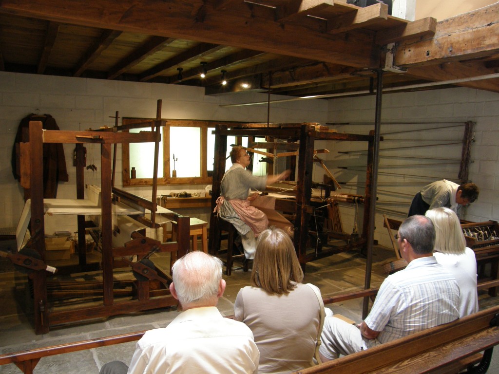
This is an exhibit showing a spinning wheel in the background and hand-loom in the foreground. A volunteer in period dress explained the way in which these machines were used by women in the cottage-industry days of cotton production.

Loom exhibit, Quarry Bank Mill, Wilmslow, UK

Loom exhibit, Quarry Bank Mill, Wilmslow, UK

One of these volunteers is showing the operation of a flying-shuttle loom, an improvement on the hand loom which made the work go faster; this loom also has an improvement which makes it possible to change the threads of the weft so as to add colored stripes or bands to the cloth. The other is setting up a spinning jenny seen in the next picture, a machine with which one woman could produce not just one, but up to 16 bobbins of thread at a time.

Loom exhibit, Quarry Bank Mill, Wilmslow, UK

Loom exhibit, Quarry Bank Mill, Wilmslow, UK

Spinning jenny exhibit, Quarry Bank Mill, Wilmslow, UK

Spinning jenny exhibit, Quarry Bank Mill, Wilmslow, UK

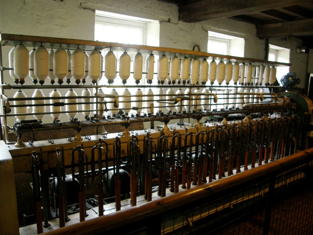
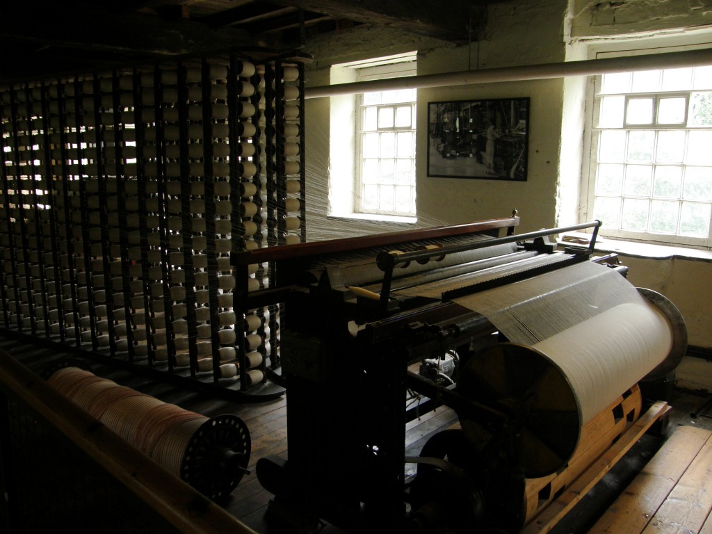
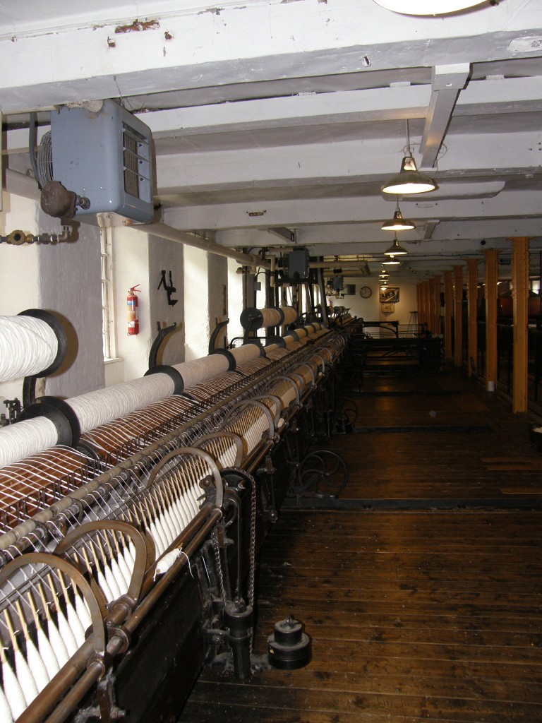
These two machines spin yard and thread onto hundreds of bobbins; the third then takes those threads and rolls them neatly onto a drum for use on the mechanized looms as the warp.

Quarry Bank Mill, Wilmslow, UK

Quarry Bank Mill, Wilmslow, UK

Quarry Bank Mill, Wilmslow, UK

Quarry Bank Mill, Wilmslow, UK

Quarry Bank Mill, Wilmslow, UK

Quarry Bank Mill, Wilmslow, UK

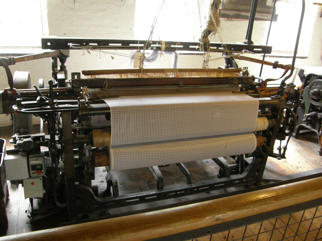
These two machines are individual mechanized looms now run with electrical motors for demonstration purposes.

Quarry Bank Mill, Wilmslow, UK

Quarry Bank Mill, Wilmslow, UK

Quarry Bank Mill, Wilmslow, UK

Quarry Bank Mill, Wilmslow, UK

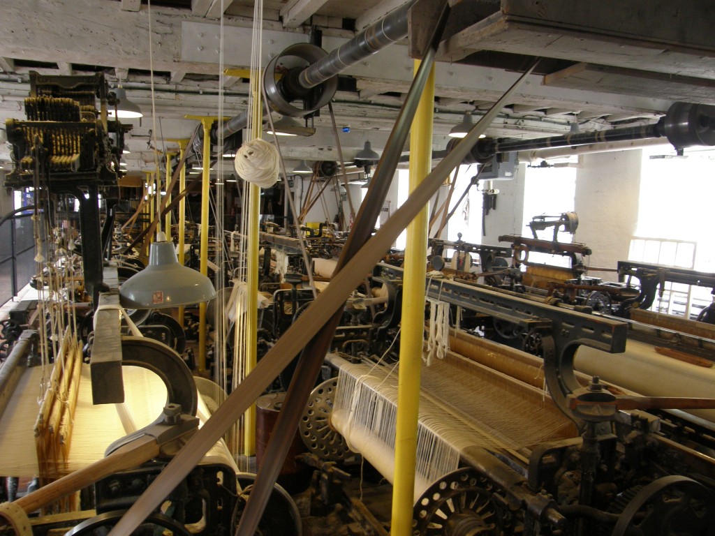
But, of course, the Greg mill didn’t rely on individual machines … a hundred or more machines were set up together, all running off a central power source (either water wheel or steam turbine). One room of the mill is set up to show what this was like and while were there a worker set only three of the machines working – the noise was deafening! I can’t imagine what it must have been like to work there with all of the machines running.

Here is a picture of the several looms together; the next picture is the bank of bobbins which feed the looms.

Quarry Bank Mill, Wilmslow, UK

Quarry Bank Mill, Wilmslow, UK

Quarry Bank Mill, Wilmslow, UK

Quarry Bank Mill, Wilmslow, UK

Men would run the looms; the apprentices (young boys about nine years of age) would go under the looms to clear jams or tie broken threads while the looms were working. As we went through the exhibit, there were several displays telling us about boys who had died from injuries received while working on running machinery.

The last display I want to share in this posting is the display of printed cotton cloth. I thought my daughter, a print maker, would appreciate this pictures of the cylindrical drums used imprint the cloth and the press on which they are used.

Quarry Bank Mill, Wilmslow, UK

Quarry Bank Mill, Wilmslow, UK

Quarry Bank Mill, Wilmslow, UK

Quarry Bank Mill, Wilmslow, UK

The Gregs were enlightened mill operators for their day. They provided fresh food and reasonably good housing for their apprentices, as well as rudimentary education. But let’s face it, the working conditions of the 18th and 19th Centuries were horrendous. One also must face the fact that large scale industrial production of cotton cloth put a vital cottage industry to death and changed an entire society.

Hand weaving of cloth and the making of clothing by hand was a staple activity of Gaelic life, as well as of English life, prior to the Industrial Revolution. In their collections of rustic charms, Douglas Hyde in Connacht in Éire and Alexander Carmichael in the islands and highlands of Scotland both recorded many songs sung by women as they worked the looms or finished the cloth; these songs reflect the rhythm of the looms or, in the case of those sung during group work like the waulking of the cloth, provided a rhythm for unified activity. (Wikipedia has a brief article about Scottish waulking songs.)

However, it was not only in these work songs that the making and working of cloth found its way into the folk songs of the Gaelic people: it was also in their love songs! The following is a song Dr. Hyde collected from Walter Sherlock of County Roscommon (because this post has gotten rather long I won’t record here the Irish, only the English). The title is The Tailoreen of the Cloth. (The ending “-een” or “-ine” added to Irish words means “little”, so in this song treasureen is a way of saying “little treasure”; tailoreen, “little tailor”. Céad fáilte is Irish for “a hundred welcomes”.)

I will leave this village
Because it is ugly,
And I go to live
At Cly-O’Gara?
The place where I will get kisses
From my treasureen, and a Céad fáilte
From my soft, young little dove,
And I shall marry the tailor.

Oh, tailor, oh, tailor,
Oh, tailoreen of the cloth,
I do not think it prettier how you cut your cloth
Than how you shape the lies;
Not heavier would I think the quern of a mill,
And it falling into Loch Erne,
Than the lasting love of the tailor
That is in the breast of my shirt.

I thought, myself,
As I was without knowledge,
That I would sieze your hand with me
Or the marriage ring,
And I thought after that
That you were the star of knowledge
Or the blossom of the raspberries
On each side of the little road.

(From Douglas Hyde, Love Songs of Connacht, page 37)

The many working songs of weaving women and love songs like this reflect a way of life ended by the Industrial Revolution so brilliantly displayed by the Quarry Bank Mill.

St. Bartholomew’s Wilmslow – 13 July 2011

Let’s back up a few days and consider St. Bartholomew’s Church in the Parish of Wilmslow; it is one of two congregations in the Parish, the other being St. Anne’s Church. Though I visited both, I was able only to get photographs at the first.

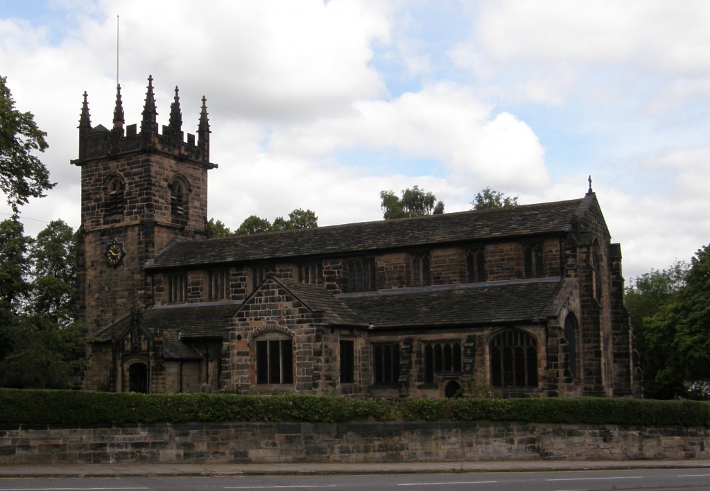
A church has been on the site of St. Bartholomew’s building since 1264, but the current building was built in the early 16th Century; all that remains of the earlier structure is a crypt below the altar of the current church. The current building also incorporates a structure from the 1400s which now forms the base of the church’s bell tower. The building is made of local sandstone which the Parish’s guidebook acknowledges is “weather-blackened”; I rather think the black discoloration is more from industrial pollution than simply from the “weather”. Wilmslow is quite close to Manchester, center of the English Industrial Revolution, and has its own very large cotton mill which used coal-fired steam to power its spinning jennies and looms; coal smoke is most likely the cause of the blackening.

This photo was taken from the city park across the street. One enters the building through a porch to the viewer’s left; the altar and crypt are at the end to your right.

St. Bartholomew's, Wilmslow

St. Bartholomew's, Wilmslow

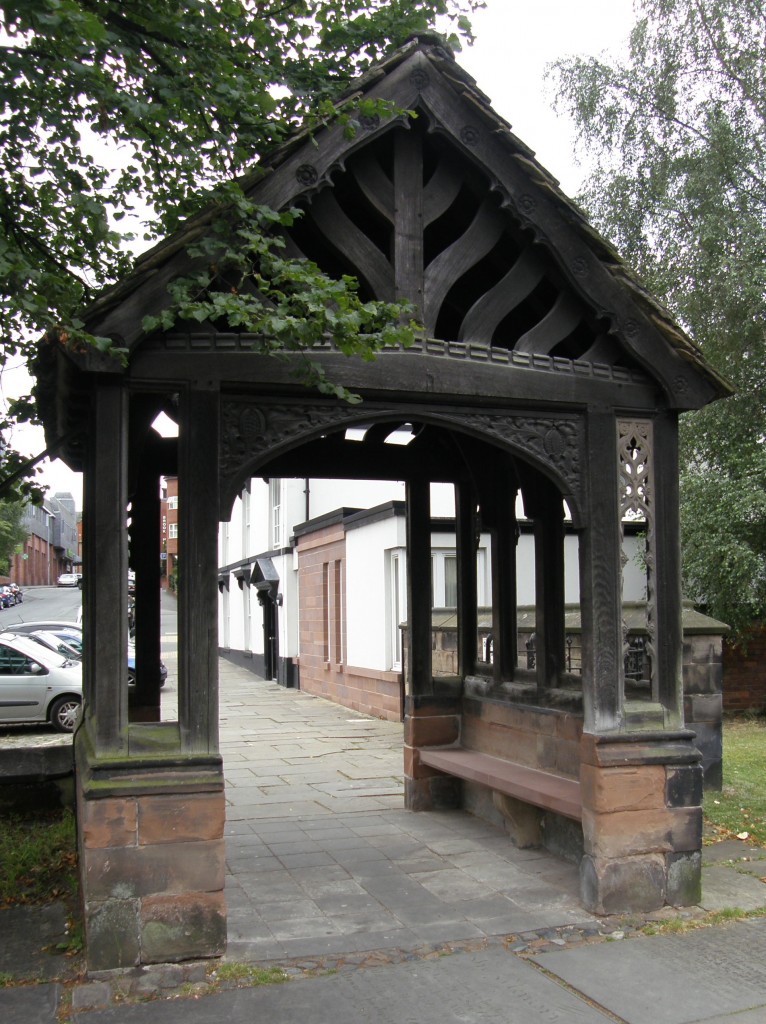
One enters the church grounds through the “lichgate”, although there are other entrances as well. I’m told that all funeral processions begin here, the officiant leading the pall bearers with the casket and the congregation following behind. According to the dictionary, a lichgate is “a roofed gate to a churchyard, formerly used as a temporary shelter for the bier during funerals.”

St. Bartholomew's, Wilmslow, Lichgate

St. Bartholomew's, Wilmslow, Lichgate

I visited the church on a Wednesday morning just a few minutes before the midweek Eucharist. I had limited time to take pictures and, with church people preparing prayerfully for worship, forebore using flash. As a result many of my interior pictures simply didn’t turn out.

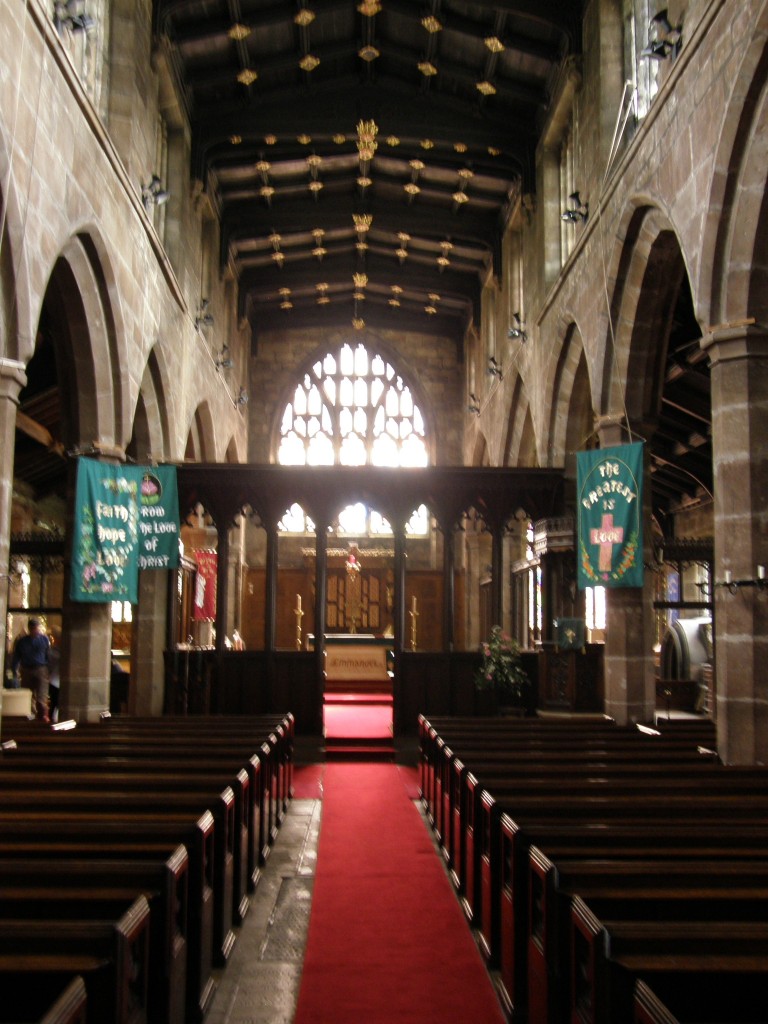
On entering the church one finds a very dark interior, typically English Gothic but with Victorian emmandations which, frankly, are a detraction! I apologize for the blurriness of this photo; given the dark lighting conditions, it was the best I could get. Notice in the ceiling a larger-than-usual golden boss (a blur really, sorry). I tried to get a picture of this, but none came out. Such bosses, whether stone or wood, usually depict stylized flowers or angels … this one is the Devil! According to the church’s history, “It is meant to show the Devil nailed in perpetuity to the roof and obliged to listen helplessly to the congregation insistently singing the praises of God.”

St. Bartholomew's, Wilmslow, interior

`St. Bartholomew's, Wilmslow, interior

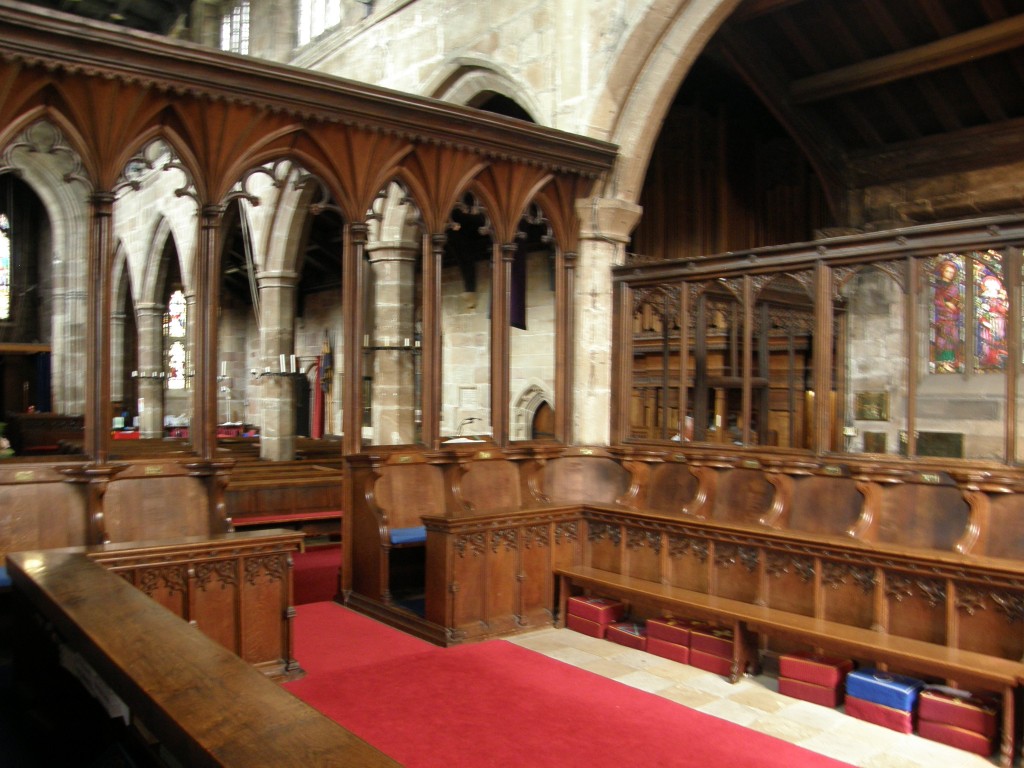
Notice the screen separating the congregation from the choir and chancel; although part of this is an original 16th Century rood screen, it was incorporated into an 1865 restoration in which all the pews in the church were replaced by the current pews and this “vestry chapel” in the choir was installed. This provided “more dignified” seating and a place for the governing board to meat. The individual, upholstered seats are labeled with brass plaques inscribed in Latin for the various offices of the board.

St. Bartholomew's, Wilmslow, interior

St. Bartholomew's, Wilmslow, interior

The church council has tried get permission from the diocese and the historical preservation authorities to remove this chapel, moving the seats to exterior walls and the screen to the base of the bell tower in order to restore a more original appearance to the church; unfortunately, that permission has been denied. If the screen were moved to the bell tower, a floor could be built at the same height as its top on which the bell ringers could stand; as things are now, the bell ringers stand on the ground floor and thus block entrance through the main door which is in the bell tower.

In the bell tower is an engraved stone plaque bearing these words: “John, son of Robert and Penelope Hunt, was killed by the first bell on Sunday, August the 30th 1767.” Apparently, the 13-year-old boy was fatally injured when the treble or smallest of the six bells broke loose from its mounting and fell on him! Those six bells are still in use today.

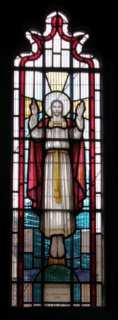
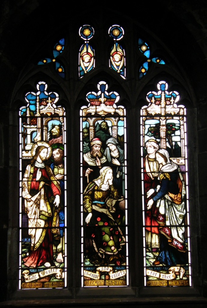
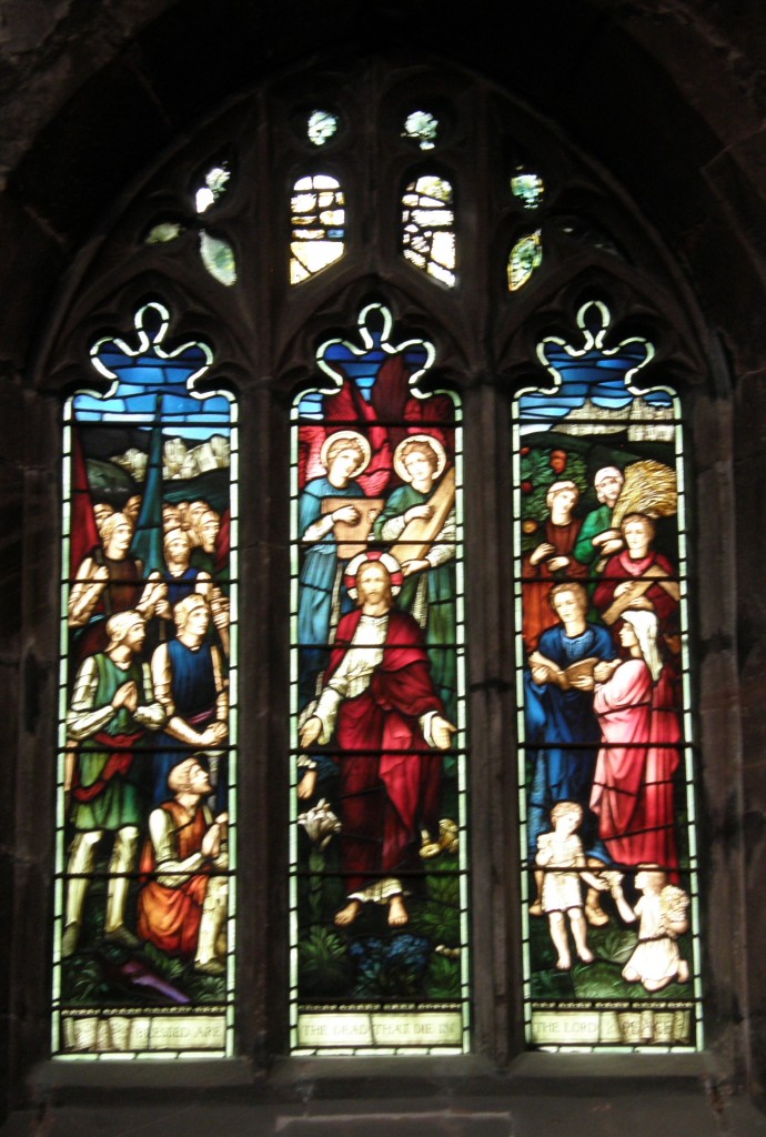
I was able to take pictures of some of the stained glass windows and here are a few of those.

St. Bartholomew's, Wilmslow, interior

St. Bartholomew's, Wilmslow, interior

St. Bartholomew's, Wilmslow, interior

St. Bartholomew's, Wilmslow, interior

St. Bartholomew's, Wilmslow, interior

St. Bartholomew's, Wilmslow, interior

St. Bartholomew's, Wilmslow, interior

St. Bartholomew's, Wilmslow, interior

I was unable to film the crypt, which is a very small, cramped space below the altar. It is believed to date from the original 13th Century church. In more modern times it fell into disuse, was filled with rubble and forgotten. During repairs to the church in the 1970s, it was rediscovered. In 1979, the Lebanese Consul in Manchester, Christian Emile Fadil, paid for its restoration in memory of his late wife. Now a chapel, the altar there is made of Lebanese cedar and on the wall are three glass panels engraved with golden lettering reading, “Pease I give unto you” in English, Arabic, and Hebrew. It has become the custom of the church that, following the Saturday evening Easter Vigil service, the clergy of the parish and others who wish to join them keep the rest of the overnight vigil in this chapel until the festival service on Easter morning.

St. Bartholomew’s is a lovely church building which evidences the faith of generations, even centuries of Wilmslow’s residents. It shows how each generation alters the church building to meet its needs to make the structure a more suitable tool for the ministry appropriate to their circumstance. It is, I believe, unfortunate that those more interested in historic preservation than in living ministry are blocking the current congregations efforts to continue in that tradition. As I was discussing this situation with my friend who is on the congregation’s ministry team, I was reminded of Jaroslav Pelikan’s aphorism, “Tradition is the living faith of the dead; traditionalism is the dead faith of the living.”

Travel Frustrations

Finally, I am in one place for more than a day or two … but getting here was a 24-hour exercise in frustration!

I drove from Wilmslow near Manchester in England to Edinburgh, Scotland, after a very pleasant visit with my friend Sally M. and her husband Tim. Sally and I had gone to the weekday Eucharist at St. Bartholomew’s Church, then toured the Quarry Bank cotton mill historical site maintained by the National Trust. Then I hit the road.

I arrived at the Quality Hotel at the Edinburgh Airport, unloaded my things, cleaned up the interior of the car and made sure I had everything out of it, then drove from the hotel to the rental car return lot … somehow making a wrong turn and ending up in a lane and an area of the airport reserved for “authorized vehicles” only (i.e., buses and taxis). Zipping quickly into an escape lane labeled FastTrack, thinking it was a quick way out of the airport, I found myself headed instead for a £26 short-term parking lot!!! Another quick lane change into a lane labeled Drop Off Only and I was in a covered drive with hundreds of people getting out of cars with their baggage; I finally made it to the exit of this area, only to find I had to pay £1 to open a gate … in any event, I made it to the car park, turned in the car, and went to find the shuttle bus to back to the hotel. On the way, I had the good idea to enter the terminal and locate the Aer Lingus ticket counter which I found at the far left end of the counters. Good, I know where to head in the early morning.

Back out to the shuttle bus and back to the hotel. I’d checked the Aer Lingus web site about baggage limitations and learned that there is 20 kilo limit on luggage, so with two bags that were packed to a 50 lb limit in the states (one about 30 lbs or 16 kilos, one about 48 lbs or 22 kilos) I knew I needed to do some shifting of items and get them more evenly distributed. That took a lot of doing … I spent nearly two hours moving things back and forth and finally getting the one down to 20 kilos (books and my CPAP machine being the heavier and harder to distribute items). Then I hied myself to the bar for a beer and a fish-and-chips dinner.

I went to bed about 11:30 p.m. setting my clock for 5 a.m. so I could get up and get the 6 a.m. shuttle in order to check in the recommended two hours before the 8:20 a.m. flight time. Tossed, turned, last looked at the clock at nearly 1 a.m. and then woke up at 4:00 a.m. and couldn’t go back to sleep. Thirty minutes later I faced the inevitable and got up, showered, finalized the packing, checked out and got to the airport at 6:00 a.m.

Loading my two bags to be checked, my carry-on backpack computer bag, and my jacket on a rolling cart, I headed to the previously scouted Aer Lingus counter … and found that it was now the City-Jet Airlines counter! And, further, that there was no Aer Lingus counter at all! I asked the young woman a the City-Jet counter what was going on. She said their counters are not permanently assigned and changed “all the time.” A young man behind her overheard our conversation and told me that Aer Lingus would open at Counter 14 in a few minutes, so I stood back and waited about 20 minutes and, sure enough, it did open up … with said young man manning the counter. I went up to check in … and he told me my luggage was 17 kilos overweight! All that work to balance the distribution between the bags and now I am told that the 20 kilo limit is “per person” not “per bag”! I would have sworn the website read as if this were a “per bag” limit, but I was reading the “Checked Bags Fees” section and not the “Checked Bags Allowances” section which I have now seen on re-reading the site. So … at £12.00 per kilo overage fee, I pay $330 to send my bags one-way to Ireland – this is $100 dollars more than the round-trip ticket to send me there and back.

Deep sigh of resignation … pay fee, get boarding pass, go off to security and the gates.

Security – guess who gets singled out for special pat-down and carry-on baggage examination.

At this point, I’m about as frustrated with everything as I can be. The Edinburgh Airport has rapidly become a non-favored place in my experience and I am ready to leave. In fact, I’m about ready to say, “This has been a great two-weeks, let’s cancel the rest of this exercise and go home!” But I don’t … I finally get to the gate … and find it’s been changed. So I go to the other gate, fortunately not far away.

Chill for 90 minutes. Go through the check-in procedure, walk out on the tarmac, enter small propeller-driven aircraft, collapse into seat.
Conversation with the woman next to me … she’s from Wichita, Kansas! An emergency physician traveling with her college-age son for a vacation in Scotland and Ireland. Very pleasant 70 minutes on the flight and we arrive at Dublin. Passport, baggage claim, customs, all no problem.

Car rental – pre-arranged months ago for a two-month long-term rental with insurance provided by my VISA card which advertises “world-wide” insurance coverage on rental cars. Except … it turns out … in Ireland, Syria, Iran, and other “terrorist countries” – Ireland? A terrorist country? Really? Long-distance call to the US to the VISA issuer confirms this. Damn! Basic insurance on the car is €15 per day, or €75 per week for a long-term rental. And, oh by the way, we don’t have your reservation … you shouldn’t have been able to do that on the website! Don’t worry, we’ll get it worked out (which they do) but it will have to be another car because we don’t have any in your reserved class with the proper registrations and permits for long-term rental. (I get a bigger car, but at some point, through the Galway office, I’ll have to trad it for the size I reserved.)

Finally, this all gets worked out and I get the car … some sort of Opel sport sedan with a diesel engine. Very posh. Feels HUGE after the little Vauxhall Meriva I’d been driving through the UK. I get my luggage loaded, get my Garmin GPS out of the suitcase, set it up on the dash, turn it on, set my destination, and move out … and get incomprehensible instructions from the GPS! The maps for Ireland are out-of-date. They have built new, high-speed motorways since these maps were produced, and in Dublin they have replaced roundabouts with American-style light-controlled intersections. Garmin’s instructions are worse than useless – they are dangerous! I turn it off and navigate by blind luck, finding my way to the Vodafone store where I am supposed to be able to convert my Nokia cellphone to local service so I don’t have to pay British international roaming charges. Guess what – Vodafone UK misinformed me – Vodafone IE can’t convert the phone. No big deal, I’ll just pay the roaming charges. I can top-up the prepayment arrangement here, so we’ll just go with that.

Back on the road … “Jack” (my Garmin) still is useless – when I’m on the motorway, he thinks I’m driving through farm fields and keeps telling me “Drive to highlighted route.” So he gets turned off again – just follow the signs to Galway. Once I get outside Galway City, Jack is fine – the road in the Gaeltacht don’t change! He guides me properly from Galway City to An Cheathrú Rua.

I arrive at my host family’s home, greet my old friends Feithín and his sister Múirin, children of my hosts, unload the car and collapse for a nap!

These 24 hours have been an exercise in frustration and patience. Thank God, they’re over. Before I take my nap … I open up Dánta Dé and I read this prayer:

Paidir mhilis thrócaire
Atá lán de ghrása
Cuirimid-ne chugad-sa
Dár gcaomhaint ar ár námhaid,
Ag luighe dúinn anocht
Is ag éirghe dúinn amárach,
In onóir na Trionóide
‘S i síthcháin na Páise.

A Íosa mhilis thrócairigh,
A Mhic na h-Óighe cúmhra,
Sábháil sinn ar na piantaibh
‘Tá íochtarach dorcha dúnta.
Leat a ghnímíd á ngearán
Óir is agad ‘tá an tseachrán
Is cuir inn ar an eolas.

In English:

A sweet prayer of mercy,
That is full of graces,
We send to Three,
To protect us from our enemies,
On our lying down tonight,
And on our rising tomorrow:
In honour of the Trinity
And in the peace of the Passion.

O Jesu, sweet, merciful,
O Son of the fragrant Virgin,
Save us from the pains
That are nethermost, dark, emprisoned.
To Thee we make our plaint,
For with Thee is our succor;
Keep us from wandering,
And guide us to [true] wisdom.

Keep us from wandering and guide us to wisdom, indeed! Amen!

Shrewsbury Abbey – 12 July 2011

Several years ago a woman named Edith Mary Pargeter began writing a series of murder mysteries set in the Middle Ages under the pseudonym of Ellis Peters. The “detective” protagonist of these mysteries was a monk named Cadfael. When dramatized by the BBC the actor Derek Jacobi played Brother Cadfael. Brother Cadfael’s monastic community was Shrewsbury Abbey, which is a real place. The abbey church of Shrewsbury Abbey still stands and is a functioning congregation of the Church of England. I visited the Abbey Church the morning of 12 July 2011.

Initially a small Saxon church, the Church of Saints Peter and Paul which was founded by Roger de Montgomery, a relative of William the Conqueror in 1083. It subsequently became a Benedictine Abbey and during the following 450 or so years it grew to become one of the most important and influential abbeys in England. In 1147, the relics of a Welsh Saint, Winefride, were brought to the Abbey and his shrine became an important place of pilgrimage. In 1283, the first English Parliament in which the Commons had a legal share took place in the Abbey Chapter House, and in 1398 Richard II summoned the Great Parliament in the Abbey. The Abbey was surrendered to the Crown in January of 1540 when Henry VIII disestablished the monasteries. Although much was destroyed, the nave continued to serve, as it does today, as the place of worship for the Parish of the Holy Cross.

In the nineteenth century plans for restoration of the Abbey were drawn up, but financial constraints compelled the building of only part of the plan; everything to the east of the pulpit and lectern are the work of the Gothic Revival architect John Loughborough Pearson, best known for designing Truro Cathedral; his work dates from 1886. The Pearson plans were put on hold and never completed because of the intervention of World War I.

Here are some pictures of the church:

This is the façade of the church seen from the small car park for the church staff:

Facade of Shrewsbury Abbey Church

Facade of Shrewsbury Abbey Church

This is the side of the church along which a major highway now runs (in the city of Shrewsbury this street is called Abbey Foregate, but it is national highway A5191 with lots of traffic). This would have been the side on which the cloister, dormitory, and other living spaces of the monastic community were built; you can see the ragged edges where the broken-down walls once adjoined the structure. The building is made of a red sand-stone native to the Shropshire area.

The interior of the church is quite large and spacious and, despite the dark stone from which it is built, natural light from the clerestory windows makes it quite bright. A very handsome painted reredos in the chancel (with a much gilt) fairly glows, and below it the altar is draped with a heavily embroidered frontal:

Nave of Shrewsbury Abbey Church

Nave of Shrewsbury Abbey Church

Reredos of Shrewsbury Abbey Church

Reredos of Shrewsbury Abbey Church

Altar Frontal, Shrewsbury Abbey Church

Altar Frontal, Shrewsbury Abbey Church

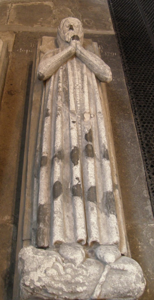
Around the side aisles of the church are tombs, such as these. The first picture is the tomb of a medieval priest; the second, of an Elizabethan couple.

Medieval Tomb, Shrewsbury Abbey Church

Medieval Tomb, Shrewsbury Abbey Church

Elizabethan Tomb, Shrewsbury Abbey Church

Elizabethan Tomb, Shrewsbury Abbey Church

There are numerous stained glass windows, old and new, such as these two. The first dates from the Middle Ages and shows the Adoration of the Magi; the second is of quite recent vintage and celebrates the Brother Cadfael series!

Adoration of the Magi Window, Shrewsbury Abbey Church

Adoration of the Magi Window, Shrewsbury Abbey Church

Brother Cadfael Window, Shrewsbury Abbey Church

Brother Cadfael Window, Shrewsbury Abbey Church

The ladies of Shrewsbury Abbey church were quite gracious when I visited. They have a small shop set up just inside the entrance to the church and a small coffee and tea bar at the rear of the left aisle. It was quite astonishing and rather funny to see a kitchen sink and countertop with modern appliances set up right next to an Elizabethan tomb, but this sort of “repurposing” is something the church needs to do and needs to do more frequently!

As I was about to leave, one of the ladies asked where I was from. I said, “Near Cleveland in the state of Ohio.” “Of course, you’re from America,” she said, “you such a lovely accent!” I nearly burst out laughing … I thanked her and went on my way, hoping to see a neolithic ring fort at Old Oswestry about an hour away. Unfortunately, road construction, indecipherable signage, and a GPS error made that impossible.

Leaving the UK

I’ve got some great photos of Shrewsbury Cathedral, St. Bartholomew’s Church (Wilmslow Parish), and the Quarry Bank Mill (in Wilmslow), I just haven’t had the time to process them and get a blog post or two written! I hope to do that in the next few days in Ireland. Today I fly to Dublin, rent another car, deal with the cell phone situation (transfer coverage from a UK company to an Irish company), and then drive to the village of An Cheathrú Rua (“Carraroe”), Co. na Gaillimhe (“County Galway”). I am to stay with Lucia and Ciaran Uí Fátharta, the same family I stayed with three years ago. (They didn’t have internet access when I was there before and I had to use the hub at the school, which was only available certain hours of the day. I’m hoping that situation has changed.) In any event, more is coming to the blog as soon as possible.

« Older posts Newer posts »